All Tours: 36
Tours
Dayton's Bluff: Below the Bluff
7 Locations ~ Curated by The Saint Paul Historical Team
The land below the Dayton’s Bluff neighborhood that rests along the Mississippi River has been the site of important places and home to many people from the earliest times until the modern era.
There was a Dakota village, an early brewery, an Irish immigrant settlement, a historic cave, a fish hatchery and a newly developed nature sanctuary.
Few physical structures of these places remain, but once they were all closely related to the community high above them and contributed to its…
Dayton's Bluff: Three Justices
3 Locations ~ Curated by The Saint Paul Historical Team
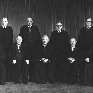
It is rare that nationally prominent judges were from the same town, but the fact that three important members of the judiciary not only lived in Saint Paul, but were from the same neighborhood is rare indeed.
They all went to Van Buren School--today’s Dayton’s Bluff Elementary-- at the same time and two of them were in the same scout troop. In their honor there is now a triangular site called Three Justices Park in Dayton’s Bluff at the intersection of Third and Maple Streets-near all of…
Dayton's Bluff: Historic Homes
3 Locations ~ Curated by The Saint Paul Historical Team
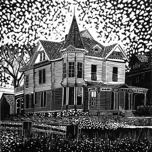
Dayton’s Bluff is filled with a rich variety of homes ranging from 19th-century Victorian structures to 1920s bungalows and postwar ranch houses. The Dayton’s Bluff Historic District, created in 1992, has been an important factor in community revitalization. The neighborhood has three homes on the National Register of Historic Places.
Dayton's Bluff: Indian Mounds Park
10 Locations ~ Curated by The Saint Paul Historical Team
Indian Mounds Park is named for the six burial mounds that are believed to have been made more than a thousand years ago. The first land parcels for the 17-acre park were purchased by the city in 1892 and added to for over a century. Its trails, picnic and recreation areas, and breathtaking views attract people from around the region.
This tour takes you from the western entry into the park to the municipal forest on the east. If you plan to ride or walk through the whole site, the western…
Dayton's Bluff: Along East Seventh Street
8 Locations ~ Curated by The Saint Paul Historical Team
Seventh Street has been the neighborhood’s main arterial since its origin. Starting in the 1880s, a streetcar ran along Seventh, attracting businesses on each side for many blocks. Most of the old companies are gone and their places have been taken by a diverse mix that includes a strong Latino and Asian presence.
Dayton's Bluff: Hamm's Heritage
9 Locations ~ Curated by The Saint Paul Historical Team
Theodore Hamm emigrated from Herbolzheim, Germany in 1854, and purchased the Excelsior Brewery on Phalen Creek in 1864. Hamm’s Brewery grew from producing five hundred barrels of beer in its first year to eventually becoming one of the country’s top beers advertising, “From the Land of Sky Blue Waters.”
Theodore and his wife, Louise lived in a mansion given to them as a surprise gift by their eldest son, William. The red brick Queen Anne Revival style home stood atop a hill overlooking their…
West End: The West Side
2 Locations ~ Curated by The Saint Paul Historical Team
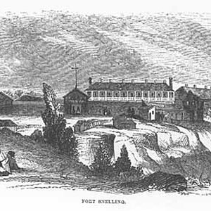
The West End is Saint Paul’s and Minnesota’s first urban neighborhood. With West 7th/Fort Road as its spine, it extends from Seven Corners near downtown to the overlook on the east bank of the Mississippi River across from Fort Snelling. This was also the last stretch of the historic fur trade route from Eastern states and Canada.
From the arrival of Zebulon Pike in 1805 to the West End of today, a number of recurring themes shaped this community’s development. Most symbolic of this process…
West End: Forming a Nucleus
2 Locations ~ Curated by The Saint Paul Historical Team
As the heads of river navigation, the Lower and Upper Landings provided a destination not just for goods but also for entrepreneurs and adventurers who were ready for a new territory and the hope of a new start. Early Saint Paul’s population expanded rapidly.
The settlement of Saint Paul was established in 1849, the same year as was the Minnesota Territory. Early settlers John Irvine, whose ferryboat dock was at the Upper Landing, and Henry Rice, a fur trader who quickly made a fortune in…
West End: Immigration
4 Locations ~ Curated by The Saint Paul Historical Team
Settlers’ and land-seekers’ endless pressure on the Federal Government rapidly displaced the Native Americans, eventually confining them in reserves with few of the promised payments or amenities. Migrants from the Eastern states, who had often made several moves before arriving in Saint Paul, joined new immigrants from Ireland and England, Germany and Prussia, Poland, Bohemia/Moravia, Slovakia, and Italy.
West End: Religious and Social Life
5 Locations ~ Curated by The Saint Paul Historical Team
Each component of the arriving populations had its particular religious needs. Religious life in Saint Paul from its earliest days was fertile, with Baptist, Lutheran, Presbyterian, Episcopalian, Jewish, African Methodist Episcopal and others established as soon as enough persons of the same religion gathered.
In 1872, the Saint Stanislav Kostka Church was established, serving both Polish and Czech parishioners but with services in Czech. The Poles established Saint Adalbert’s Church. In…
West End: River and Rail Commerce
2 Locations ~ Curated by The Saint Paul Historical Team
Infrastructure and commercial development proceeded rapidly, supported by the intense river trade that brought all kinds of goods and people to the area. River commerce that seemed invulnerable was really at the start of its long decline and defeat at the hands of the railroads. Riverboat companies and their commercial advocates ashore managed to convince the Federal Government to undertake an escalating series of river channel improvements from 1866 to 1925. By 1925, when the six- and nine-foot…
West End: Community Development
5 Locations ~ Curated by The Saint Paul Historical Team
Beginning in the 1950s, urban renewal and interstate highway construction became central issues for cities. The design of Shepard Road as the central link from downtown to the airport and points west and south required that the Upper Levee, home to vital components of the West End community since the 1850s, be cleared, infilled and prepared for potential industrial use. At Seven Corners, the Civic Center project went forward with the clearance of block after block of buildings, without much…
Frogtown: Why Call it Frogtown?
5 Locations ~ Curated by The Saint Paul Historical Team
Located northwest of downtown Saint Paul, the area known historically as Frogtown includes several smaller neighborhoods: Mount Airy, Capitol Heights, Rondo, Lower Rice Street and East Midway. The Burlington Northern Santa Fe (BNSF) Railroad tracks, Interstate 35E, University Avenue, and Lexington Parkway are borders of the Saint Paul planning district called Frogtown, but the historic neighborhood boundaries extend south of University several blocks. The planning district, which is now Frogtown…
Frogtown: Railroad Roots
5 Locations ~ Curated by The Saint Paul Historical Team
Saint Paul’s status as the hub of transportation, goods and services for America’s Great Northwest was tied to the advent of railroads here. For more than 100 years, countless Frogtown residents provided the labor that kept railroads operating.
Today’s Great Northern Business Parks, Empire Builder Business Park and the Minnesota Transportation Museum are the remnants of what was once a vast area of rail and roundhouse facilities, a foundry and suppliers for the railroads. The promise of jobs…
Frogtown: School Days
9 Locations ~ Curated by The Saint Paul Historical Team
Frogtown has been home to more than a dozen public, parochial, and charter schools over the years. In the early days Frogtown children went to school close to home years ago and almost always walked to school.
Most of the first schools were too small for each grade to have its own classroom. Two or more classes shared a room, with one teacher to help the pupils.
In early schools desks were bolted to the floor, with inkwells for the older children to dip their pens into. (Sometimes a…
Frogtown: Minnehaha Avenue Memories
4 Locations ~ Curated by The Saint Paul Historical Team
Minnehaha Avenue is one of Frogtown’s major east-west streets. Years ago it marked a section line on early land surveys. In later years it served as a dividing line between part of Frogtown’s residential and commercial-industrial areas.
Some histories indicated that part of Minnehaha was considered for the name University Avenue because it was envisioned as a connection between Hamline University and the University of Minnesota. The name Minnehaha comes from Henry Wadsworth Longfellow’s 1855…
Frogtown: Who We Were and Are
11 Locations ~ Curated by The Saint Paul Historical Team
Frogtown has always been one of Saint Paul’s most ethnically diverse neighborhoods. Much of the neighborhood’s ethnic history can be followed through its churches, its community institutions and its businesses and industries. Several of those destinations are noted in the other tours.
French-Canadians were among the earliest settlers here. Also present in the early days were Germans, Austrians, Irish, Poles, Hungarians, Romanians and other Eastern Europeans. Scandinavians and Italians also…
Frogtown: We Gather in Worship
9 Locations ~ Curated by The Saint Paul Historical Team
Frogtown’s many old and beautiful churches are one of the neighborhood’s best-kept secrets. Although much attention is focused on the neighborhood’s Catholic churches, especially Saint Agnes, Frogtown also has a long Lutheran heritage. It also has had Congregational, Methodist, Nazarene and other faiths over the years.
Typically people worshipped in their home neighborhoods. Where a church was located often played a role in where a family chose to live.
Churches often started in members’…
Frogtown: Centers of Commerce
12 Locations ~ Curated by The Saint Paul Historical Team
University Avenue is Frogtown’s best-known commercial street. It was once home to one of the Twin Cities’ busiest streetcar lines. The University Avenue line connected the downtown areas of Saint Paul and Minneapolis, and also served the University of Minnesota. It also connected to several other streetcar lines including Rice Street and Dale Street. University was the premiere streetcar line in terms of ridership numbers. It served shoppers as well as commuters.
METRO Green Line light rail…
Rice Street: A Street that Works
6 Locations ~ Curated by The Saint Paul Historical Team
Located in the North End neighborhood, Rice Street began as a commercial corridor that served St. Paul’s working class. Rice Street is unassuming; when it was rushed into being more than a century ago, there was no time for ornamentation or ostentation. Despite its utilitarian appearance, Rice Street has a character that is unique to the street and the North End. A trip along Rice Street reveals a rich neighborhood history with proud ethnic and working class roots. Rice Street was and is a…
Along Selby
7 Locations ~ Curated by The Saint Paul Historical Team
Follow Selby Avenue west from where it begins. At Selby Avenue’s beginning, you will find remnants of the empire-building years of the late 19th-century atop Cathedral Hill. Here lived people of wealth, ambition, and ostentation. A little farther along, there are vestiges of the city’s expansion along streetcar lines.
This tour follows the streetcar line west, with short forays into the neighborhoods north and south. It has literary, architectural, and commercial features.
Those with…
Cathedral Hill
6 Locations ~ Curated by The Saint Paul Historical Team
The best place to begin an exploration of Cathedral Hill is where Summit Avenue and Selby Avenue meet. This is the edge of what St. Paul’s early residents called St. Anthony Hill. The site offers one of the city’s best views: to the north, the Capitol; to the east, downtown below and Dayton’s Bluff in the distance; and to the southeast, Cherokee Heights. The observer blessed with imagination may see it as it was before transformed by the human hand: the tree-lined river gorge, the great turn of…
West Side: The Flats
5 Locations ~ Curated by The Saint Paul Historical Team
The contours of the earth define and set apart Saint Paul’s West Side. On the north, the great swoop of the Mississippi forms the point and two sides of a rounded triangle; a line of sandstone cliffs--the shore long ago of the glacial River Warren--forms the base. The low plain inside the triangle, the flats, has invited immigrants, industry, and floods for more than a century and a half. The immigrants and those who followed them eventually expanded the West Side south to the city limits at…
West Side: Prospect Terrace
7 Locations ~ Curated by The Saint Paul Historical Team
No site offers better views of downtown Saint Paul than the bluffs of Prospect Terrace, once the West Side’s answer to Summit Avenue. Scanning from east to west you can see Dayton's Bluff and Indian Mounds Park; Metro State University; the lowlands (now Bruce Vento Nature Sanctuary) where Trout Brook and Phalen Creek once flowed into the Mississippi; downtown Saint Paul, with the Capitol and Cathedral rising above; and downtown Minneapolis far in the distance.
The neighborhood bounded…
West Side: Yoerg's Heritage
4 Locations ~ Curated by The Saint Paul Historical Team
Anthony Yoerg (1816 – 1896) came to St. Paul from the little town of Gundelfingen, Bavaria in 1848. St. Paul was still a village then, and the big German migration to Minnesota was just beginning. He opened the state's first brewery, near where the Science Museum stands today, in 1849. In 1870 the Yoergs moved across the river to the West Side and built a new brewery at the base of the bluff, and dug five caves into the soft sandstone; the caves offered cool and stable temperatures for storage.
West Side: Beyond the Bluff
9 Locations ~ Curated by The Saint Paul Historical Team
The top and edge of the bluff, overlooking the river valley, was the precinct of the well-to-do and mostly still is. But once you get just a few streets south, the neighborhood becomes more varied and, for some, more interesting.
Start near the base of the slope that rises west from Wabasha Street, at the corner of Humboldt and Robie. St. Matthew’s School, built in 1902, is probably the second-oldest school building in the city, after St. Joseph’s Academy/Christ’s Household of Faith (1863).…
Selby Avenue: Labor History
5 Locations ~ Curated by The Saint Paul Historical Team
The “Selby Avenue” neighborhood got its label in the 1960's, after the construction of Interstate 94 largely destroyed the African American district known as “Rondo,” so called after its main thoroughfare. The demolition and clearing of a block-wide swath between Rondo and St Anthony Streets containing most of the black owned businesses and other institutions displaced hundreds of African American residents, and cut out the heart of the community. Prior to its destruction, Rondo, as the axis of…
Frogtown: Lost Frogtown
9 Locations ~ Curated by The Saint Paul Historical Team
Like so many of St. Paul’s first-ring neighborhoods, Frogtown has lost more than its share of historic and unique structures. Businesses and industries, churches, schools and countless homes have been torn down or burned down. Whether it was a large and once-grand home, an old corner store, a church or a barn on the back of a lot, the lost buildings of Frogtown leave holes in the community fabric.
Some of the pieces of Lost Frogtown, including institutions, schools, businesses and homes, are…
Historic Lowertown
22 Locations ~ Curated by The Saint Paul Historical Team
Layers of history give Lowertown its unique appeal. The Saint Paul neighborhood that sprouted at the "Lower Landing" on the Mississippi River grew into a major warehouse and distribution center serving the entire Upper Midwest. Lowertown's railroad, manufacturing, and wholesaling companies expressed their sense of pride and permanence in the structures they erected nearly a century ago. In 1983 Lowertown was listed on the National Register of Historic Places, giving the area protection under the…
African American Heritage: Frogtown Area Churches
6 Locations ~ Curated by The Saint Paul Historical Team
While none of Saint Paul’s historic African-American churches are in what we know today as Frogtown proper, churches in adjacent neighborhoods served Frogtown’s African-American community. These were the churches Frogtowners could walk to.
The churches with the longest histories are Pilgrim Baptist, Saint Peter Claver, Saint James African Methodist Episcopal (AME) Church, Mount Olivet Baptist and Saint Philip’s Episcopal.
Other historically African-American churches were south of…
West End: Labor History
6 Locations ~ Curated by The Saint Paul Historical Team
St Paul’s “West End” is on an intermediate plateau, located between the bluffs rising on the north side of the neighborhood and the bluffs on the south side that descend to the Mississippi. Running southwesterly from Seven Corners to the Fort Snelling Bridge, its main arterial street, West Seventh, was once known as “Fort Street,” and is now co-named “Fort Road.”
“Is Dis Here Goin’ to Fort Street or Fort Street?”
Fort Street used to continue past Seven Corners along what is now named “Main…
African American Heritage: Points of Entry
16 Locations ~ Curated by The Saint Paul Historical Team
Minnesota's African American history begins with pioneers who trapped, traded and developed lasting relationships with the Indian nations. In the 1790s, Pierre Bongo (Bonga or Bungo), a free black fur trader, came to the territory and married an Ojibwe woman. Their son, George Bonga, born in 1802, was Minnesota's first recorded African American birth. George became a fur trader, too, as well as an important interpreter who helped negotiate agreements between the Ojibwe and the U.S.
From…
Walking Up Payne Avenue
10 Locations ~ Curated by The Saint Paul Historical Team
“Growing up on Payne Avenue was like living in a small town,” former resident DeAnne Cherry once wrote. “My family knew all the merchants and Payne Avenue was where we spent our money.” While this remembrance dealt with the area's life in the 1950’s, the story goes back to a time before Minnesota became a state. Like many other streets, it is named after an early resident, but in this case there is a somewhat unusual story.
In 1856, thirty-eight year old Rice W. Payne of Virgina set out on a…
Saint Paul: Cultural Heritage
17 Locations ~ Curated by The Saint Paul Historical Team
Saint Paul, with its ethnic festivals, diverse neighborhoods, cultural traditions and historic sites, wants to share its culture and heritage with the world. Saint Paul is truly a big city with small town charm. Quaint neighborhoods and family destinations are its cornerstones. Museums featuring art, history, and more make it a cultural hot spot.
We've got culture - and heritage - so it just makes sense to invite you to experience our stories.
3M & Saint Paul
29 Locations ~ Curated by Saint Paul Port Authority | Marjorie Pearson, Summit Envirosolutions, Inc. | the East Side Arts Council
Minnesota Mining and Manufacturing, as 3M was originally named, moved from Two Harbors, MN, to the Dayton's Bluff neighborhood in St. Paul in 1910 and was headquartered there until 1962. The company started with sandpaper and abrasives, and eventually became a major international corporation making a wide variety of products. 3M closed all operations at it's Dayton's Bluff location in 2009. The on-site interpretive program and and this online resource were developed with funding from the Saint…
Mapping the Early Synagogues of the West Side
7 Locations ~ Curated by Barbara Bezat
This is an unusual "tour", in that none of the buildings remain. In fact, most of the streets are long gone as a result of the city's plan to demolish over 500 structures located on the flood plain of the Mississippi River across from downtown. Map locations are approximate as most of the addresses and streets no longer exist.
The first Eastern European Jews arrived in the late 1880s and settled primarily in what was once called the “Lower West Side” of St. Paul. The majority of them were…