Featured Stories
3M & the Community
3M Engages the Community
“By contributing to, and participating in civic projects, 3M and 3M employees have helped to strengthen the bond of community relationship. The unique characteristic of 3M's…
West End: An Introduction
Saint Paul’s West End is Minnesota’s first urban neighborhood. With West 7th/Fort Road as its spine, it extends from Seven Corners near downtown to the overlook on the east bank of the Mississippi…
Gita Ghei: Bubblicious, 2014
Bubblicious 2014 Material: steel, aluminum, solar lighting This sundial-inspired artwork evokes the visual imagery of creatures whose bodies are comprised of 90% or more water - jellies, rays, and…
Take a Tour
Dayton's Bluff: Along East Seventh Street
8 Locations ~ Curated by The Saint Paul Historical TeamSeventh Street has been the neighborhood’s main arterial since its origin. Starting in the 1880s, a streetcar ran along Seventh, attracting businesses on each side for many blocks. Most of the old companies are gone and their places have been taken by a diverse mix that includes a strong Latino and Asian presence.
West End: Community Development
5 Locations ~ Curated by The Saint Paul Historical TeamBeginning in the 1950s, urban renewal and interstate highway construction became central issues for cities. The design of Shepard Road as the central link from downtown to the airport and points west and south required that the Upper Levee, home to vital components of the West End community since the 1850s, be cleared, infilled and prepared for potential industrial use. At Seven Corners, the Civic Center project went forward with the clearance of block after block of buildings, without much…
Frogtown: Why Call it Frogtown?
5 Locations ~ Curated by The Saint Paul Historical TeamLocated northwest of downtown Saint Paul, the area known historically as Frogtown includes several smaller neighborhoods: Mount Airy, Capitol Heights, Rondo, Lower Rice Street and East Midway. The Burlington Northern Santa Fe (BNSF) Railroad tracks, Interstate 35E, University Avenue, and Lexington Parkway are borders of the Saint Paul planning district called Frogtown, but the historic neighborhood boundaries extend south of University several blocks. The planning district, which is now Frogtown…
African American Heritage: Points of Entry
16 Locations ~ Curated by The Saint Paul Historical TeamMinnesota's African American history begins with pioneers who trapped, traded and developed lasting relationships with the Indian nations. In the 1790s, Pierre Bongo (Bonga or Bungo), a free black fur trader, came to the territory and married an Ojibwe woman. Their son, George Bonga, born in 1802, was Minnesota's first recorded African American birth. George became a fur trader, too, as well as an important interpreter who helped negotiate agreements between the Ojibwe and the U.S.
From…
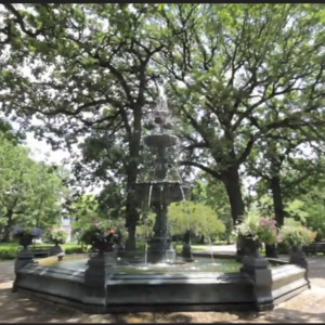
West End: Forming a Nucleus
2 Locations ~ Curated by The Saint Paul Historical TeamAs the heads of river navigation, the Lower and Upper Landings provided a destination not just for goods but also for entrepreneurs and adventurers who were ready for a new territory and the hope of a new start. Early Saint Paul’s population expanded rapidly.
The settlement of Saint Paul was established in 1849, the same year as was the Minnesota Territory. Early settlers John Irvine, whose ferryboat dock was at the Upper Landing, and Henry Rice, a fur trader who quickly made a fortune in…
About
Saint Paul Historical
A project by Historic Saint PaulSaint Paul Historical is a free mobile app that puts Saint Paul's history at your fingertips. Explore the people, places, and moments that have shaped the city's history. Click on any point on the interactive map to read historical narratives and to view images. Take curated historical tours of Saint Paul and share our stories and your experience using social media. This project has been financed in part with funds provided by the State of Minnesota through the Minnesota Historical Society from the Arts and Cultural Heritage Fund. This site is powered by Omeka + Curatescape, a humanities-centered web and mobile framework available for both Android and iOS devices.
Read more About Us