Featured Stories
"Say it ain't so, Charlie!"
- The dispute between Charles Comiskey and orgainzed labor over the opening of Lexington Park -
On April 30, 1897, St. Paul's legendary Lexington Baseball Park opened to the public for the first…
West End: An Introduction
Saint Paul’s West End is Minnesota’s first urban neighborhood. With West 7th/Fort Road as its spine, it extends from Seven Corners near downtown to the overlook on the east bank of the Mississippi…
Brewery Workers, Bosses and Consumers
German workers and German bosses had a monopoly on brewing beer in St Paul, as they did almost everywhere in the United States in the 19th and early 20th centuries. As historian Gary Brueggeman has…
Take a Tour
Frogtown: School Days
9 Locations ~ Curated by The Saint Paul Historical TeamFrogtown has been home to more than a dozen public, parochial, and charter schools over the years. In the early days Frogtown children went to school close to home years ago and almost always walked to school.
Most of the first schools were too small for each grade to have its own classroom. Two or more classes shared a room, with one teacher to help the pupils.
In early schools desks were bolted to the floor, with inkwells for the older children to dip their pens into. (Sometimes a…
Frogtown: Minnehaha Avenue Memories
4 Locations ~ Curated by The Saint Paul Historical TeamMinnehaha Avenue is one of Frogtown’s major east-west streets. Years ago it marked a section line on early land surveys. In later years it served as a dividing line between part of Frogtown’s residential and commercial-industrial areas.
Some histories indicated that part of Minnehaha was considered for the name University Avenue because it was envisioned as a connection between Hamline University and the University of Minnesota. The name Minnehaha comes from Henry Wadsworth Longfellow’s 1855…
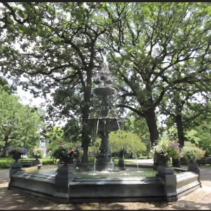
West End: Forming a Nucleus
2 Locations ~ Curated by The Saint Paul Historical TeamAs the heads of river navigation, the Lower and Upper Landings provided a destination not just for goods but also for entrepreneurs and adventurers who were ready for a new territory and the hope of a new start. Early Saint Paul’s population expanded rapidly.
The settlement of Saint Paul was established in 1849, the same year as was the Minnesota Territory. Early settlers John Irvine, whose ferryboat dock was at the Upper Landing, and Henry Rice, a fur trader who quickly made a fortune in…
West Side: The Flats
5 Locations ~ Curated by The Saint Paul Historical TeamThe contours of the earth define and set apart Saint Paul’s West Side. On the north, the great swoop of the Mississippi forms the point and two sides of a rounded triangle; a line of sandstone cliffs--the shore long ago of the glacial River Warren--forms the base. The low plain inside the triangle, the flats, has invited immigrants, industry, and floods for more than a century and a half. The immigrants and those who followed them eventually expanded the West Side south to the city limits at…
Dayton's Bluff: Below the Bluff
7 Locations ~ Curated by The Saint Paul Historical TeamThe land below the Dayton’s Bluff neighborhood that rests along the Mississippi River has been the site of important places and home to many people from the earliest times until the modern era.
There was a Dakota village, an early brewery, an Irish immigrant settlement, a historic cave, a fish hatchery and a newly developed nature sanctuary.
Few physical structures of these places remain, but once they were all closely related to the community high above them and contributed to its…
About
Saint Paul Historical
A project by Historic Saint PaulSaint Paul Historical is a free mobile app that puts Saint Paul's history at your fingertips. Explore the people, places, and moments that have shaped the city's history. Click on any point on the interactive map to read historical narratives and to view images. Take curated historical tours of Saint Paul and share our stories and your experience using social media. This project has been financed in part with funds provided by the State of Minnesota through the Minnesota Historical Society from the Arts and Cultural Heritage Fund. This site is powered by Omeka + Curatescape, a humanities-centered web and mobile framework available for both Android and iOS devices.
Read more About Us